views
Several parts of the country received rains on Friday resulting in sub-normal maximum temperatures, while the weather office predicted no heat wave for coming five days and a stronger monsoon over south and central India next week.
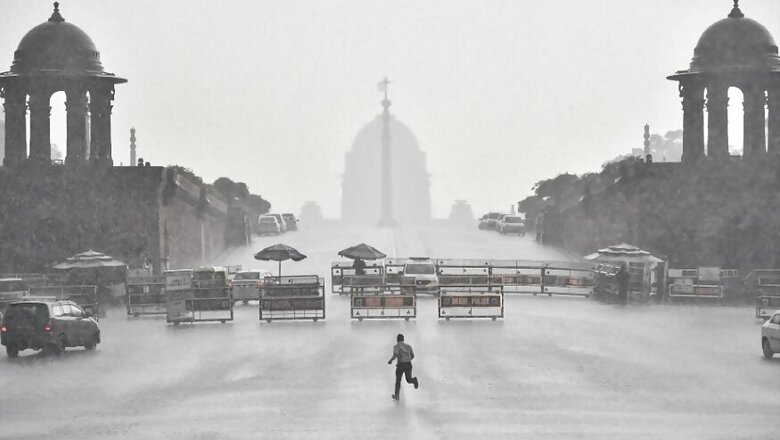
The national capital and nearby states including Punjab, Haryana and Rajasthan received rains during the day.
Delhi's Safdarjung Observatory recorded 1.2mm rainfall, while the weather stations at Ayanagar and Lodhi Road gauged 21.7mm and 0.6mm. Winds gusting up to 50-kmph swept across the city.
Kuldeep Srivastava, the head of the regional forecasting center of the India Meteorological Department, said an active western disturbance in northwest India and moisture incursion due to cyclone Nisarga led to the rains. He also said the region is not likely to witness a heat wave till June 15.
In its daily national heatwave bulletin, the IMD said Kavali (Coastal Andhra Pradesh) recorded the highest maximum temperature in the country at 40.2 degrees. "No heat waves are likely over the country during next 5 days," it said.
Meanwhile, in its monsoon update, the weather office said rainfall activity in central and south India is likely to pick up pace from next week due to a cyclonic circulation likely to form over the Bay of Bengal that may aid the progress of the monsoon, that hit Kerala on June 1.
IMD Director General Mrutunjay Mohapatra said a low pressure area is likely to form over the Bay of Bengal and move towards Odisha next week.
A low pressure is a cyclonic circulation and the first stage of any cyclone. However, it is not necessary that every low pressure intensifies into a cyclone. "This will help advance monsoon and bring good rainfall during the next week," Mohapatra said.
The IMD had earlier predicted that the monsoon would be delayed by four days, but cyclone Nisarga helped push the monsoon to reach Kerala on its normal onset date.
"Conditions are becoming favourable for further advancement of Southwest Monsoon into some more parts of central Arabian Sea, Karnataka, Tamil Nadu, Puducherry and Karaikal, southwest and east central Bay of Bengal, entire southeast Bay of Bengal and some parts of west central Bay of Bengal during next two days," the IMD said.
According to the IMD, the country as a whole has received 9 per cent more rainfall than the normal since June 1.
Meanwhile, northern states of Haryana and Punjab too received rains and their maximum temperatures continued to remain below the normal limits.
Chandigarh, the common capital of the two states, which received rains in the evening, recorded a maximum temperature of 33.2 degrees Celsius, six notches below the normal.
In Haryana, Ambala's maximum settled at 33.2 degrees Celsius, six notches below the normal, while Karnal recorded a high of 33 degrees Celsius, six degrees below the season's average.
Hisar's maximum settled at 37.1 degrees Celsius, five notches below the normal, while Narnaul registered a high of 34.8 degrees Celsius, eight notches below the normal. Amritsar in Punjab recorded the maximum temperature at 35.8 degrees Celsius, down five notches against normal limits.
In the northwest, several places in Rajasthan recorded light to moderate rainfall with Barmer receiving maximum of 22mm.
Ajmer and Kota recorded 5.1 and 4.1mm rainfall while few other places also received pre-monsoon showers below 4mm during the period from morning till evening, according to the meteorological department in Jaipur.
Bikaner and Ganganagar recorded maximum temperatures of 38.6 degrees Celsius each, closely followed by Churu where the day temperature touched 38.5 degrees Celsius. The day temperatures in other areas was below 38 degrees Celsius.
Parts of Bihar also witnessed rainfall. In the northeast, road connectivity to the remote district of Shi-Yomi in Arunachal Pradesh snapped after a bridge was washed away in the floods triggered by incessant rains over the last couple of days.
Shi-Yomi district, bordering China, was cut-off from the rest of the country after the RCC bridge (reinforced cement concrete) near Yapik village on the Aalo-Mechuka Road was washed away on Wednesday night.
Movement of people and essential commodities to the remote district would be badly affected as it is likely to take days to restore the bridge, officials said, adding that people travelling between Mechuka and Aalo were also left stranded.


Comments
0 comment