
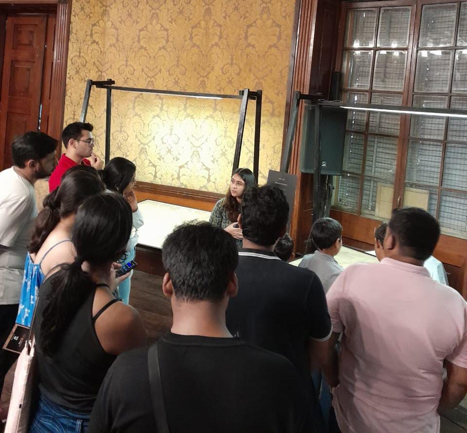
Nowadays, maps on mobile devices have made our lives very easy. Even if we want to reach any unknown location, we can check the best routes and means of travel to that place while sitting at home. On encountering traffic congestion, with the help of modern digital maps, we can find detours to reach our desired destination in seconds. But have you ever thought about how these maps were developed? Or how maps were actually drawn when there was no modern-day technology? If you want answers to all these questions and more, then Mapped, curated by Past Perfect Heritage Management LLP along with The Rotary Club of Bombay and the Asiatic Society of Mumbai, is the best place.
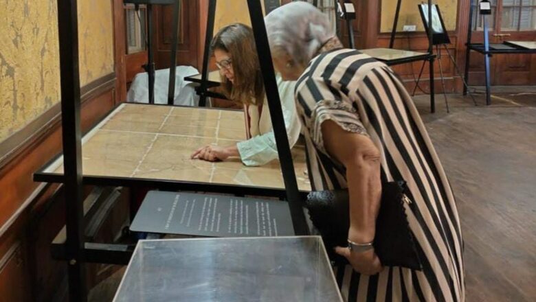
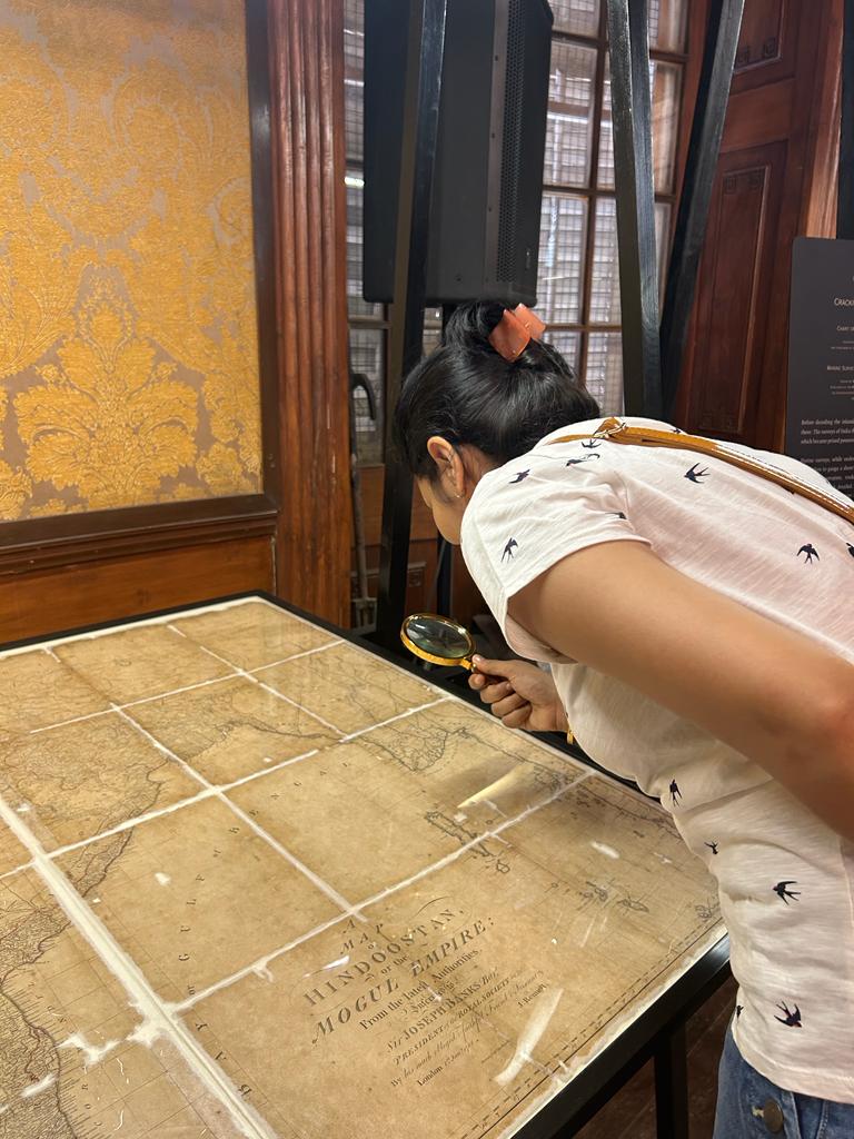
This year, the exhibition has the first accurate map of India made by Major James Rennell, the father of the Indian Survey and the first Surveyor General of Bengal. It is also known as the first map of ‘Hindoostan’ or ‘Mogul Empire’. Major James Rennell first published the map in 1782 and then revised it in 1788. According to historians, though there is no official record that shows how much time he took to make this map, the entire process including the survey would have taken around 10-15 years. The narrative focuses on the presence of the English East India Company in Bengal and a transition in its priorities and power in the region and over the rest of India. It emphasises the importance of the lucrative coasts of India in terms of trade and entry points into the subcontinent and how the fall of certain native Indian rulers expedited the colonial state’s consolidation of power and improved governance in its newly acquired colony.
At the exhibition, the organisers also explain the emergence of the Great Trigonometrical Survey of India, which was one of the most advanced and extensive mapping exercises in the history of the world, and its impact and relevance in contemporary times. An idea first envisioned and spearheaded by William Lambton, the measurement of the Great Arc of the Meridian which forms the backbone of the Great Trigonometrical Survey, was later completed by George Everest.
This exhibition, on till June 4, not only speaks about maps and how they were developed but turns the pages of history and takes you into the past to understand the geopolitical situation of that time. It also throws light on how the British took the help of native Indians in this entire process of making maps. Old Hindoostan maps kept for display also show that maps were drawn from the Indian side, as then surveyors did not have access to other neighbouring countries. But later, the British took the help of native Indians who used to work as spies and visit the neighbouring countries to help the surveyors get all the crucial information to make a map. These spies possessed a great deal of local knowledge and measured a large part of undivided north India in disguise on foot while risking their lives, and were critical to this undertaking.
Deepti Anand, co-founder of Past Perfect Management LLP said, “As curators of this exhibition, we have been very conscious about bringing to light the value of maps as records of history. There’s a larger story behind the creation of each map and we believe that people should be able to discover layers of a single object through these stories. The maps on display this year are those produced as part of the Great Trigonometrical Survey of India and it’s been a riveting journey for us as curators to understand the techniques, failures, and successes of executing a mapping exercise of this scale. We knew just a selection of maps with labels wouldn’t do justice to the stories that document the exercise and have therefore, with the guidance of the Rotary Club of Bombay and Asiatic Society of Mumbai, added to the exhibition by displaying rare books, an interactive digital display, a reading corner and more such elements that would make visitors want to explore more.”
The second half of this exhibition is more interesting as it shows the past of present-day areas like Tardeo, Kamathipura, Grant Road, Girgaon, Umerkhadi, Mazgaon, and Byculla. The maps of these areas were part of city planning at the time and look at surveying as a tool to establish greater control over the lands and their inhabitants. These areas were surveyed under Colonel George Laughton between 1865 and 1872. These city maps are extremely detailed, which shows how the inhabitants made sense of their urban spaces and influence the way land, reclaimed or otherwise, is used today. The city maps also show the exact location of the first mill of India in the Tardeo area of south Mumbai. Later in 1999, in the same location, the first mall of Mumbai called Crossroads was built. It also shows how the planning team had counted the coconut trees in Girgaon of south Mumbai. Volunteers also explain why coconut trees basically got a place on the map and what was their importance from the revenue point of view. In the exhibition, marine maps of India have also been kept, which depict the sea levels in each area and where corals and rocks are in the deep sea.
According to Dr Shehernaz Nalwalla, vice president, The Asiatic Society Of Mumbai, “With exhibitions such as these, we are looking forward to having the public interact and access our rich collection of rare maps. Our collection of the Great Trigonometrical Survey maps reveals some of the earliest detailed and precise maps made of the Indian subcontinent. By mapping the subcontinent and neighbouring countries, the British wanted to increase their power over the people and these maps, therefore, have numerous stories linked to them.”


Comments
0 comment